Friday, May 13, 2011

Shroud Cay

 We stopped in at Shroud Cay after leaving Warderick Wells for a night in another spot with some natural attractions. The mooring field is totally exposed to the West as are most anchorages down in the Exumas but we paid close attention to the forecast allowing us to anticpate a restful night at a remote location.
 Since we filled up the dink at Staniel Cay we had plenty of fuel in it to carry us around and after launching it we left for the North end of Shroud Cay. The water was calm enough so we crossed over to Little Wax Cay (I have no idea how they dream up some of these names) landing Madonna for a walk on the beach.
 There is an obvious difference between the beachs of the Exumas versus those of the Abacos. They are much cleaner in the Exumas. Up in the Abacos plenty of plastic and other forms of debris land on the beaches making shelling a sometimes disturbing passtime. It's pretty shameful to see those beaches as cluttered as they get with bottles, cans, flip flops, and all sorts of rubish that floats in. Beach glass is fine, since it can be used to create something artistic like jewelry but the amount of plastic that washes in makes me look out into the ocean wondering what people are doing out there.

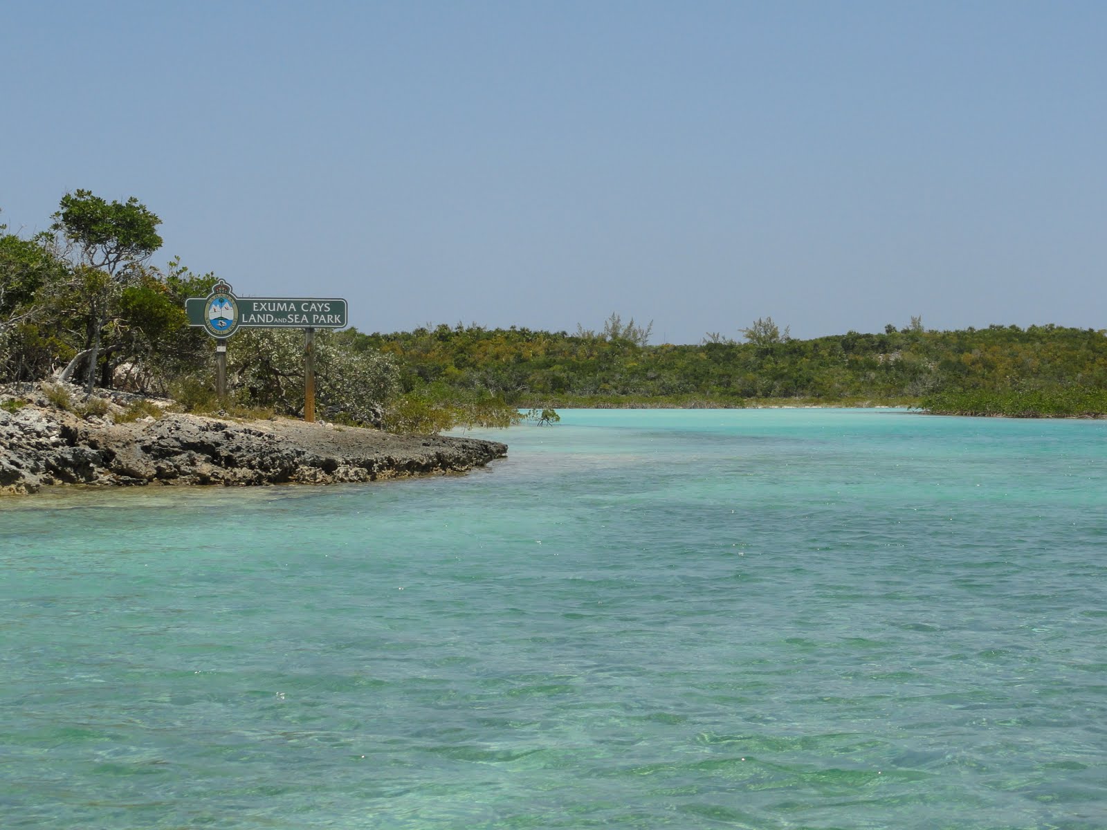
 Anyway, since taking anything out of the Exumas Land and Sea Park is in violation of their regulations we left any interesting shells we saw where they were as much as we didn't want to. After the walk we left for the return to Shroud Cay and located the entrance to Sanctuary Creek. Since the tide was coming in we made our way up the creek all the way to the Atlantic side.  This was the most interesting part of the stay at Shroud Cay that we found although with persistance someone could probably locate better snorkeling than what was charted as Neptunes Oasis.
 Speaking of snorkeling, Thunderball Groto back at Staniel Cay was the highlight of our swimming. If one waits for low slack tide, one can enter into the cave and exit the other side into an area of coral and fish that will surely please most. I cannot remember a snorkel that was packed with as much variety and color of fish, sponge and coral unless it was much farther South.
 After all of the riding around was done we packed up the gear and loaded the dink onto the davit at the transom of Freedom. We settled into the sunset hoping for the green flash but a cloud line on the horizon prevented the possibility of one appearing.
 Once dinner was done and we laid down for the evening the wind clocked around and the dink started squeeking against the davit with the wave action. If the CIA needs help I have something that will probably work as well as water boarding.

Tuesday, May 10, 2011

We Got to Represent

 There is a hill on Warderick Wells Cay known as Boo Boo Hill. The walk up to it isn't so bad, but if one is not cautious a serious injury could be the result. This would not be from a fall from height, but merely a fall to the ground with your foot stuck in a hole. Fortunately this didn't happen to either of us either time we walked up to the hill.
 The first time up to the hill we learned of the legend where people leave driftwood inscribed with their boat name piled up on the peak. The notion here is that by contributing to the heap of driftwood name boards we placate the ghosts inhabiting the island. The contribution is also considered to be an offering to the spirits of good weather for traveling boaters. So we had to find a piece of driftwood suitable for use as a name board.
 Given this first walk up the hill was the longer walk that took us around a good chunk of the cay and over some very rough terrain we kept our eyes open for driftwood. But this walk took us over all of the other hills and away from beaches and we came up empty handed. The next day we were out and about in Madonna the dink and after landing on a number of beaches in the area we finally found some driftwood.
 So I fashioned up a board and we took it up to the top of Boo Boo Hill and laid it down on the pile full filling our obligation to the ghosts and spirits of the seas. Our representation has been achieved.
 This makes another mark in the long term goals of cruising the Exumas. Without question Warderick Wells offers up an amazing panorama from atop Boo Boo Hill. While there isn't much here, what is here is spectacular. Our time on mooring ball #9 was enhanced by the fact that there is a sunken sailboat underneath us depending on which way the tide is moving. On incoming tide the wreck is directly under us, and outgoing we can see it a little ways off. At night with the transom lights on large yellow tails swim about and smaller ones dart in and out of the light. Small angle fish can be seen within the wreck very clearly. We also had two days of calm winds that kept the Atlantic side flat calm. So Deb got quite an eyeful with the look bucket even though it wasn't really needed. Even though I was standing up driving I could generally see most of what she could since the water was that clear.
 We also had quite a bit of company out here. Bananaquits would fly into the aft deck early in the morning and later in the afternoon looking for a hand out. Once they got to know you they would eat out of your hand after landing on a finger. Good company but they crap all over everything. Nothing like another high maintenance friendship.
 With that it's getting to be time to move on again. I'll upload some more photos in a day or two when we get better bandwidth. Right now, it's 10 bucks for 24 hours or 100 megabytes which ever happens first.

Friday, May 6, 2011

Staniel Cay

 Back on Wednesday the 4th we traveled from Compass Cay down to Staniel Cay. The ride down was calm and without issue or so we thought. Arriving here at the Staniel Cay Yacht club we found the water to be just as clear as that of Compass Cay however the view off the aft deck was a relatively unobstructed panorama of the Bahama Bank and it's turquoise water.
 It wasn't long before things got interesting here. Fishermen returning to the marina gathered at the fish cleaning station and held up some awesome looking Mahi (Dolphin). When they started to throw the scraps into the water, nurse sharks showed up. You'll also note that Ray is not above looking for some Mahi snacks. After a couple of days it became obvious that they know about the fish cleaning station because they lay on the bottom waiting for scraps on a regular basis.
 Staniel Cay itself is composed of a relatively small community without much going on except for the Yacht Club we are staying at. Small pathways in town lead to the grocery stores and upon arrival the owner will turn on the lights for you. Everyone is saving money however they can these days. We attempted to get to the beaches on the East side of the Cay but we were unable to locate a safe path down from the bluff we found ourselves on. Perhaps with the addition of a golf cart tomorrow we will be able to locate a good path to one of the beaches.
 However in the mean time we were able to get out in the dink and check out some of the nearby Cays. In particular we went to Big Majors Spot, and Bitter Guana. Both of these cays have interesting inhabitants that run out to greet approaching boats. In fact, some are so happy to see you they will swim into the deeper water where the boats anchor for the evening. But that only happens at Big Majors Spot.
 The locals on Bitter Guana are members of the endangered Exuma Islands Iguana club. http://www.iucn-isg.org/actionplan/ch2/exumaisland.php
 These reptiles actually hear approaching boats and run down to the beach to see if anyone has interesting bits of food to eat. We had some Belgian Endive with us and it seems they have good taste in their selection of veggies. They readily accepted the Endive, and also enjoyed some Romain lettuce. There were many of them in attendance and I'd say the total topped out at about 20 of them on the beach at one time. They regularly threatened each other and would chase one another away if their space was invaded. It wasn't long before we learned just how fast these critters can run. Given they have some nasty looking claws we kept our distance staying close to the water since they seemed as though they wanted no part of it.
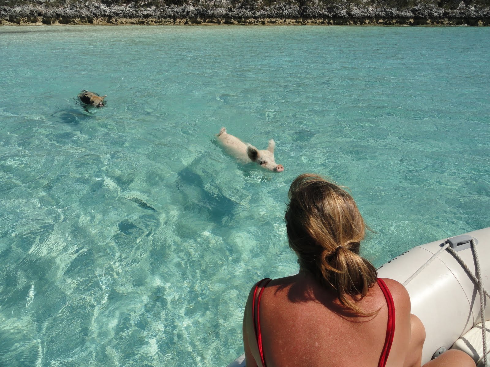
 But over on Big Majors Spot the pigs swim on out to check out your offerings. If they don't line up with their palate, they swim away towards another boat. The above greens didn't work well for them and they left it floating in the water or on the sand of the beach. We elected to stay in the dink since we had heard they can be aggressive. We also kept the dink in a few feet of water so they had nothing to use as a base to jump into the dink with. Another couple came in with their dink and all of the pigs went over to see what they had. They actually got out of their dink and went to feed them by hand on the beach. I don't participate in feeding wild animals out of my hand ever since I saw someone teasing a large black bear in Yellowstone park. While he got away with it, the impression it left on me is permanent. Anyway I guess the pigs were a bit upset because we had nothing interesting and they spent extra energy swimming around and sure enough the lady was nipped while feeding the big ol' sow that pushed her way to the front of the pack. After she screamed it wasn't long before they were back in the dink as well.
 So don't feed wild pigs. They may look pleasant with spots and such but they have teeth and use them.
 With all of the traveling this year I've had to create another link for the GPS tracks, they file size got too large for the Google Earth conversion program. But all of the tracks are there. I've also uploaded additional photos into the bucket -> http://s252.photobucket.com/albums/hh40/danno53/Boating%202010-2011/

 By the way the reason for the remark about an uneventful trip, is that the people that installed our new shaft seals did not polish the shafts and the seals have worn enough to start leaking already. Insert explitives.


Monday, May 2, 2011

Compass Cay

 I open by saying that without question this facility is one of, if not the most interesting and enjoyable stops we have made with Freedom or any of the other boats we have owned. It rivals all of our travels except, perhaps, French Polynesia.
 The ride down from Highbourne was uneventful except for one Grand Alaskan style 80 footer that blew by us at 20+ knots leaving a wake about 7 feet high when it caught us.
 Otherwise we were mowing down the wind generated 2-3 footers that were coming straight at us. It was lumpy but nothing like the offensive rolling we absorbed after passing through Fleeming Channel on the way to Nassau. But it was enough to deposit copious amounts of salt all over Freedom yet again. Fortunately our water maker is working well this year so I can get after the salt once in a while at  a reasonable cost.
 Upon arriving at the entrance channel to Compass Cay one is greeted with shallow water. They have channel markers that sort of match up with the cartography we have so in spite of what was a imposing appearance we moved on slowly. This makes the entrance to Cocles Harbor on Shelter Island look like a cake walk. Heading up into the Navesink in New Jersey was a breeze in comparison. Propeller scour marks in the bottom were a frequent observation.  I was constantly bumping Freedom in and out of gear even though we only require a bit less than 4 feet of water to prevent damage to the running gear. By the way, there is no place South of Spanish Wells that can haul our boat let alone some of the large yachts down here. We made our turn in and we were immediately greeted by Tucker the owner of Compass Cay.
 They really make you feel at home here, and he congratulated me for being a first timer that did not run aground. The hindsight based on that remark was somewhat sobering.
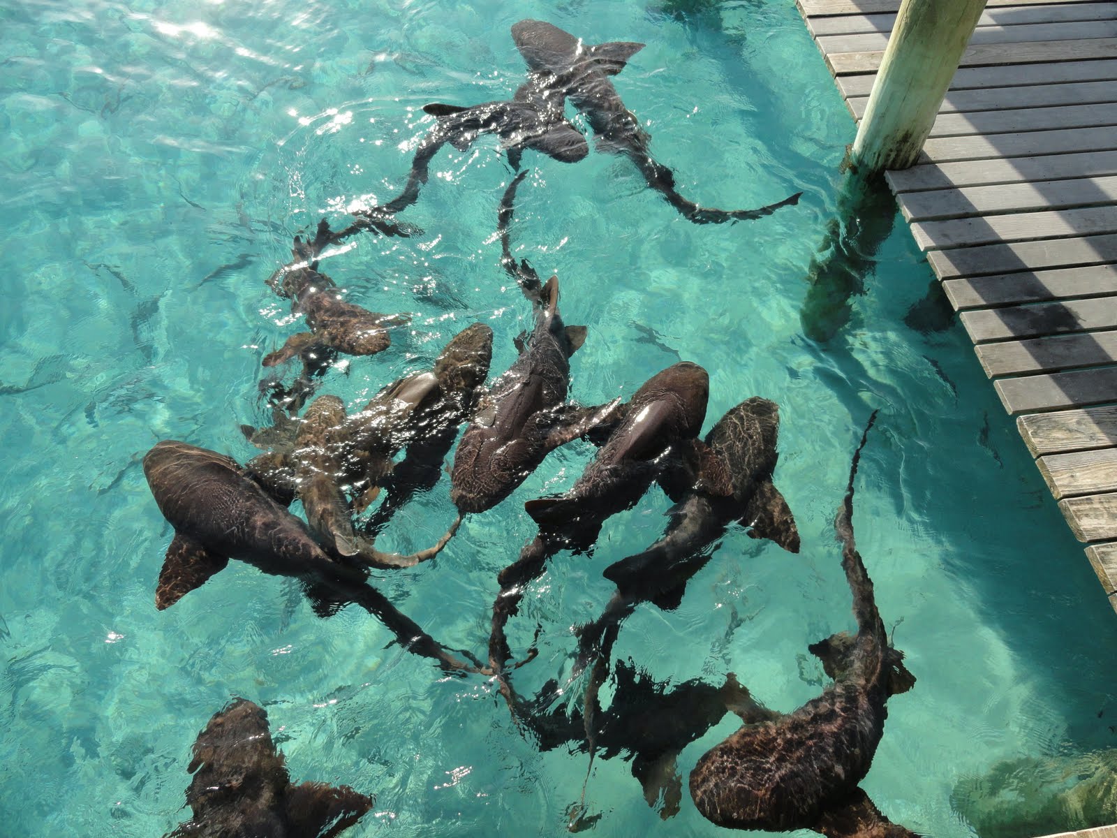
 When a new boat pulls in all sorts of fish show up to see what scraps you might have to throw in for them. Many nurse sharks, snapper, grouper, and triggers, cloud the water looking for a hand out. With water that is crystal clear to 20 feet it makes us feel as though we are floating in an aquarium. Part of an acrylic bauble.
 While all of these nurse sharks are docile, something like big salt water cat fish, there are others lurking about. For example once in a while a large barracuda will pass through. This shot was taken at the marina shark feeding station. The dock at the right of the photo is actually submerged during high tide and the sharks swim up onto it and wait to be fed. Reaching down and petting them discloses just how rough their skin is. It feels something like 80 grit sand paper. Certainly different from a Hudson River catfish. No slime.
  Today we went out in the dink and made it over to Sampson Cay for a burger. It was actually reasonably priced and quite good. The conch salad was fresh and we are certain of that since they were cleaning it when we pulled up to the dock and the chef left the kitchen to go get some.
 The ride over was interesting in that we had to cross a few ocean openings when the tide and wind were in opposition and the ocean is rough. Although we were well inside, some serious rollers and breaking waves were coming at us. It was challenging to get through it all while standing up in the dink. Deb was sitting but when cruising around in shallow water if you don't want to run aground it's advisable to stand for a better perspective.
 Regardless of the challenge, we were both taken aback by just how scenic it is down here.

 The GPS data is uploaded and these photos will have to suffice until we get some more bandwidth.

Sunday, May 1, 2011

Nassau and Paradise Island

 We were both relieved to be in Nassau. We'd had a rough ride into town and we both wanted some rest after it. So we walked over to a local Chinese restaurant and had a dinner that was actually quite good. It wasn't long before we were out cold snoring away.
 In the morning we decided to get over to Paradise Island and check out Atlantis.  The forecast was improving so we walked along the shoreline of the harbour towards the bridges. The East side of the Harbour has a number of marinas and quite honestly some of them have been beaten down by years of use and storms. The view of the Harbour on this side is full of derilict boats sinking, floating, and sort of floating. It gives one pause to reflect on how a government would tolerate this situation when it is so dependent on tourism.
 And then there is the other extreme. The Atlantis marina is loaded with Megayachts. Including the one that ran its generator all night long in Spanish Wells because he was too cheap to pay for power. I would have thought the generator in a 110 foot Lazzara would have been more quiet than that one was. By the way it's not in this photo. 
 The hotel itself is massive and loaded with attractions that look tempting enough. We walked through quite a bit of it. But it's loaded with people and after the quiet life in the Abacos this past Winter it's not something we are the least bit acclimated to. We much prefer the walks on beaches that are less traveled and actually have some shells to collect.
 With that we made our way back to the boat and checked in on the weather. As it turned out Saturday was a good day to travel so we booked reservations at Highbourne Cay and Compass Cay. Right after I get off the phone, Deb discovers her Strep throat has turned into scarlet fever. So we walked out to another walk in center and fortunately the good doctor there prescribed some more medication to clear up the residual indications of Strep.
 So off we went for Highbourne on Saturday. As it turns out the dockmaster here is terrific. She remains cheerful in spite of our making and canceling reservations. That and all of the larger yachts are demanding special treatments and attention. For example, it could take one 45 minutes to get into the marina on Highbourne and if you can do it in 5, they wonder what your problem is if you scoot in front of them when they are going about a 1/2 a knot 2 miles away from the place.
 But the water here is very clear and today we move on to Compass for a bit of a stay and some relaxation. I might even get to launch the dink!

 The GPS data is current and I'll load up some more photos shortly. No dissing on the lack of photo comments please.


Friday, April 29, 2011

Spanish Wells to Highbourne Cay

 Well, not really. The forecast was for winds around 15 knots out of the East and the wave height predictions appeared to be within reason for us to make a transit from Spanish Wells to Highbourne Cay. The notion here was that we'd have a following sea until we rounded Yellow Bank after which point we'd be in the lee of that bank on the way to Highbourne Cay. The path we chose to take had us head SW out of Spanish Wells to a point past Meeks Patch. Then we'd go South West to Current Rock. From there we were going to turn to the Bank and pass through Fleeming Channel with a heading towards the West end of Yellow Bank where we would then turn towards Highbourne Cay.
 It started out all well and good and it turned out that the wave height predictions were on the low side. Cool we thought, and life is good.
 Note these predictions were also associated with the area South East of Current Island, Shilling Cay, and Rose Island which all form a sort of barrier between the Bahama Bank to the South East, and, the North East Providence Channel which we were in. The bank is shallow at around 15-20 feet. The N.E. Providence Channel is not shallow. It's deep as I have spoken about previously. While we commiserated with other boaters over the VHF radio about our intentions and theirs along the way we settled into a ride that included a few squalls that washed off some of the salt Freedom had been accumulating from the spray she'd been exposed to already.
 That clean feeling didn't last long.
 We turned into Fleeming [break] I'll call this Flaming Channel since it rolled up on us and we started stuffing the anchor into the next wave [/break] and motored along with about a knot and a half of current pushing us backwards even though we thought we hit this after low tide during a lull in the current. We associated the rough water with the fact that we were in the cut and it's residual tidal flow. So we soldiered on. Stooopidt that was. We should have turned around and gone back out to the N.E. Providence Channel and bailed out on going to Highbourne immediately. What was supposed to be about another 6 hours or so of boating had turned into a projected 6 hours of hell.
 Our course after this passage through Fleeming (sp based on my prior remarks) is not the least bit direct or smooth. We started to hunt for a path that gave us a relatively comfortable ride along our projected path but we had no luck. In fact, we kept ducking shallow spots of 15 feet because with 4 footers rolling under us we were starting to get concerned that Freedom would bottom bounce if we hit a very shallow spot that was not charted.
 But it all passed and after quite a bit of rolling and rocking we found ourselves committed to a trip across the Bank into Nassau. What would have been another 6 hours was now only 2 hours of bad boating. There are passages back out to the N.E. Providence channel but given the seas, shifting tide, and wind, we came to a consensus that a direct path to Nassau was the best possible route to take. It genuinely sucked, but it was a better decision than running a narrow break in the barrier with unforgiving water, wind and current. But we made it to Nassau ok. We pulled into the Nassau Harbour Club where dock hands met us and in spite of our rattled bones, we tied up without incident in a slip that is only two feet wider than Freedom.
 Once again the Exumas was looking like a destination to be denied.
 Upon arrival I was informed that all sorts of changes were going to take place. No solar panels, no more thought of Staniel Cay in the Exumas. If anything, that was a destination achieved only via airplane. I agreed. I did not argue. It really sucked that badly out there. Freedom rolls quite a bit and without a lower station it's all accentuated. It was fortunately only about 3 hours of some serious chop that was following us of the port side. It was about 2-3 most of the time but at a 2-4 second interval and steep. So it really shoved us around and had us pitching. But Freedom, to her credit just kept pushing us along and delivered us. Every cabinet, freezer, refrigerator, cupboard, compartment and cabinet was booby trapped with objects spilling out when opened, but Freedom delivered and in great form. A bit crusty with salt, but here we are parked in the shadow of Atlantis.

 Did I mention Deb has Strep throat and that this was her birthday? Ok, but we both  knew the goal was to get her into the Exumas on a good passage. Oh well. Maybe another time. Lightening is flashing in the sky off to the East of Nassau.


Wednesday, April 20, 2011

Eleuthera or translated, Freedom

  On a number of occasions here in Eleuthera I was pleasantly surprised by the smiles the name of our boat generated. After the second pleasantry I was given a very simple explanation. When the island was settled over 300 years ago the folks that did so were looking for religious freedom and since they found it here, the name was cast. It's a shame they had to ship wreck on the Devil's Backbone in the process. Eleuthera Origins
 Now depending on who you talk to, they will tell you the name Eleuthera has different origins and one of the alternative origins is based on the separation of the Bahamas from the U.K.. At least that is what the folks have told me. So I say run with what works and we'll be grateful it doesn't mean something else to the people! Anyway, here is a photo of Preacher's Cave looking out. It's right off the Devil's Backbone that wrecked them way back when. Fortunately they were able to find some shelter there because the terrain in this area offers little protection from the elements. Something like 70 people shared this cave until they could work out better facilities.
 To get over to the main island of Eleuthera from Harbour Island we took the water taxi. It's nothing fancy and all the locals depend on it to get to work on either side of the harbour. It's a generic 26 footer or so with a couple of outboards and people pile into it at the price of five bucks a head each way. Once on the other side we hooked up with a road warrior style taxi to get to the North Eleuthera Service Center where the ride was waiting for us.
 The ride was an older but still fully functional Lincoln Town car that set us back 80 bucks for the day plus gas. At the end it drank 11 gallons and took a substantial portion of the 100 dollar cash deposit we left behind. But she ran good and carried us over the entire length of Eleuthera on the left side of the road without issue.
 Along the way South we stopped in at the Glass Window, Hatchet Bay, Governors Harbour, and North Palmetto. Having passed through all of these we then visited Rock Sound and its blue hole and continued on to Cape Eleuthera which was one of our intented stops with Freedom along the way to the Exumas.
 The Glass Window is a repaired natural bridge that connects Eleuthera and lets the ocean pass under. Yes, the island is that narrow at this point. It reminds me of the bluff just North of Sea Spray on Elbow Cay. On the way down the tide was in and water was passing through to the West underneath the bridge. While the tide was out on the way North, we could hear the relatively light surf crashing into the walls of the shoreline with authority.
 If I was to chose an island that was more interesting to tour by car, I'd give it to Eleuthera hands down. The island has more terrain as opposed to the flatness found on Abaco, and everything is open in stark comparison to the gated communities found in Outer Islands of the Abacos. Not only that but since the island is narrow, often times the roadway is on the shoreline and the views provided by this proximity are nothing less than spectacular.
 It seems as though no matter where you look there is a panorama including the turquoise waters that transition to royal blue or pale light green. But it's not really about driving to the views over here, it's about walking the beaches, enjoying the water and kicking back to the pace the Bahamas lives by. 
  I've uploaded more photos of these stops and the trip along Eleuthera to the bucket.